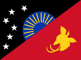
Located in the Sandaun Province of Papua New Guinea. It covers a land area known for its diverse geography, including coastal areas, rivers, mountains, and forests. The district is home to a population that engages in a variety of economic activities.
Agriculture plays a significant role in the district’s economy, with key crops including cocoa, coffee, oil palm, copra, and vanilla. The fertile land and favorable climate provide favorable conditions for agricultural production. Additionally, fishing is an important economic activity due to the district’s coastal location and proximity to the Pacific Ocean. The district also has potential in the forestry sector, with abundant timber resou rces available for sustainable logging and processing. Mining activities, particularly small-scale mining for gold and other minerals, are also present in certain areas.
Infrastructure and service delivery remain areas for improvement in the district. Access to quality healthcare, education, and transportation services are key challenges that need to be addressed for the district’s development. Overall, Aitape-Lumi District offers economic opportunities in agriculture, fishing, forestry, and mining. Continued investment in infrastructure and services can help unlock the district’s potential and improve the living conditions of its residents.
Nuku District is a district of Sandaun Province of Papua New Guinea. Its capital is Nuku which is a major center of Torricelli linguistic diversity. The Torricelli languages are a family of about fifty languages of the northern Papua New Guinea coast, spoken by about 80,000 people. They are named after the Torricelli Mountains. The most populous and best known Torricelli language is Arapesh, with about 30,000 speakers.
Subsistence Agriculture: Subsistence farming is a common economic activity, with local communities cultivating crops such as sweet potatoes, taro, yams, bananas, and vegetables for their own consumption.
Raising livestock such as pigs, chickens, and cattle provides a source of income and food for local communities. iven the coastal location, fishing and aquaculture activities are prevalent, with communities engaged in coastal or river fishing, as well as fish farming.
Local markets and small shops contribute to economic activities, providing goods and services to the community.
The production and sale of traditional handicrafts and artwork, such as carvings, woven items, and pottery, can be an economic activity.
It covers an area of approximately 8,320 square kilometers and is situated in the remote and mountainous region of the country. The district is named after its administrative center, Telefomin, which is a small town surrounded by rugged terrain. Telefomin District is home to various indigenous communities, including the Telefol people who are the predominant ethnic group in the area. The district’s population engages in subsistence agriculture, primarily cultivating crops such as sweet potatoes, taro, and bananas for their own consumption. Livestock rearing, hunting, and gathering also play important roles in the local economy.
Due to its remote location, Telefomin District faces significant challenges in terms of infrastructure development, access to basic services, and communication networks. The rugged terrain and lack of road connectivity make transportation difficult, which impacts trade and economic development. The district’s communities often rely on traditional systems and have limited access to modern amenities.
The unique natural surroundings, including lush forests, mountains, and rivers, provide opportunities for ecotourism and adventure activities. However, the district’s tourism potential remains largely untapped due to limited infrastructure and accessibility. Efforts are being made to improve the living conditions and livelihoods of the people in Telefomin District. Initiatives include promoting sustainable agriculture practices, enhancing education and healthcare services.
Vanimo Green River District encompasses an area of approximately 5,164 square kilometers and is situated along the northern coast of the country, bordering Indonesia. The district’s name is derived from its administrative center, Vanimo, which is situated near the mouth of the Green River.
The district is characterized by its diverse natural landscape, featuring pristine beaches, lush rainforests, and the meandering Green River. It is home to various indigenous communities, including the Vanimo people, who have traditionally relied on subsistence agriculture, fishing, and hunting for their livelihoods. Vanimo Green River District serves as a key trade and economic hub for the region, benefiting from its strategic location near the border with Indonesia. It serves as a gateway for cross-border trade and commerce, facilitating the exchange of goods and services between Papua New Guinea and Indonesia. The district’s economy is primarily driven by agriculture, forestry, fishing, and small-scale businesses.
